Florence County Waterfalls
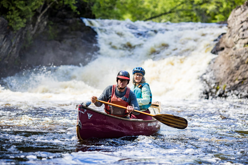
Deep in the forest, the waters of Florence County's Wild Rivers cascade, tumble and roar down 8 breathtaking waterfalls. To see pictures of the falls, click on the video gallery. Nature's Water Park offers guided waterfall tours. Call 941-536-8090 for reservations. Trails to the falls range from 1/4 mile to a little more than one mile. Trails are primitive in some areas so good footwear is a must. Little Bull Falls can only be reached by water. Canoers and kayakers may put in at the Morgan Lake Rd/Popple River crossing. Little Bull Falls in one half mile downstream from the crossing and should be portaged by all but expert paddlers due to rapids both up and downstream.
PINE RIVER:
Breakwater Falls: (Latitude 45.829301, Longitude -88.253583) Three tiers of cascading falls, with rapids, create this spectacular 60-foot waterfall just below the Pine River Dam. Unique rock formations of 2 billion year old bedrock show the power of the river and beauty of nature. Breakwater Falls changes drastically with water flow: thundering at high flow and intricate ledge flows during low flow. The south side has the best trail, while the north side offers a high bluff view and delicate back channel falls. To get to the south side, turn west on Power Dam Road off of Hwy N. After 1.25 miles stay right at the 'Y'. The road dead ends at the Pine River Dam power house. Park there, walk around the gate and up the gravel road. At the top of the road follow the signs down to the top of the first tier. The trail along the river is primitive and requires a climb up hill after the 3rd tier to get back up to the road. To see the falls from the north, turn south on Pine River Road off of Hwy D. Follow Pine River Road to the Pine River Flowage We Energies campground. From the parking lot, walk down to the dam and follow the foot path to the falls.
LaSalle Falls: (Latitude 45.831013, Longitude -88.290010) With a 22-foot plummet, LaSalle Falls is the most impressive waterfall in the area. The trail ends at the 35-foot rock outcrop next to the falls, but the best view is to use the trail to the base of the falls. Downstream of the falls is a gorge, filled with rapids, that runs for 1/2 mile. The best view of the area is in a canoe or kayak at the end of the gorge. If you only visit one waterfall, make this the one. To get to the falls from the south, turn north off of Hwy C on to LaSalle Falls Road. Follow LaSalle Falls Road about 2.5 miles to a parking lot on the north side of the road. A medium difficulty hike of about 1 mile leads you to the falls. From the west and Washburn Falls, follow White Ash Road and LaSalle Falls Road about 4 miles from Washburn Falls to the parking lot.
Meyers Falls: (Latitude 45.899845, Longitude -88.436188) The best view of 7-foot cascading Meyers Falls is from the north. The rocky terrain surrounding the falls is very unique and picturesque. To get to the north side drive 7.5 miles west of Florence on Hwy 70 turn left onto Goodman Grade Rd at the WI Wild River access signs #13-#15. Follow signs for #13 Meyers Falls on the gravel road to the right for 1.5 miles to a grassy parking area. The falls is only 25 yards from the lot, so listen for the roar. To get to south side drive 11.5 miles south of Florence on Hwy 101 turn right onto Patten Lake Rd. Drive 3.5 miles and turn right onto North Shore Rd. This road turns into Goodman Grade Rd. Follow the blue waterfall signs. Just south of the Pine River, turn left, drive 1/2 mile and park near a fork in the road. It is a short walk to the falls.
Bull Falls: (Latitude 45.898143, Longitude -88.409908) Bull Falls is small (5-feet), and some may not consider it a waterfall, but if you enjoy the tranquility of rushing water, this is a great place to visit. There are interesting yellow birch root formations next to the river. To get to the falls follow the directions to Meyers Falls then turn left at the #13-#15 intersection about 1 mile off Hwy 70. Follow this logging road 0.9 mile to a small parking area. It's is a short walk down to the falls.
POPPLE RIVER:
Washburn Falls: (Latitude 45.811271, Longitude -88.365233) This Falls has the easiest access to enjoy the tranquility of a truly wild river. This cascading waterfall drops 6-feet over a series of ledges. The best view is from the peninsula that juts out in front of the falls. Reaching the peninsula involves climbing down a rocky hill and crossing a small stream. This is a great picnic spot. From the south, turn left on Sunrise Road, about 5 miles east of Hwy 101 on Hwy C. Follow this winding dirt road 4 miles to a parking lot on a sharp curve. An 1/8-mile walk ends at Washburn Falls. From the east, Washburn Falls is about 4 miles from the LaSalle Falls parking lot on LaSalle Falls Road.
Little Bull Falls: (Latitude 45.766048, Longitude -88.457523) Little Bull Falls can only be reached by water. Canoers and kayakers may put in at the Morgan Lake Rd/Popple River crossing. Little Bull Falls in one half mile downstream from the crossing and should be portaged by all but expert paddlers due to rapids both up and downstream.
Big Bull Falls: (Latitude 45.797016, Longitude -88.408597) This falls has an island in the middle. The north channel, is Big Bull Falls, while the south channel is a cascade of smaller falls. Follow the rustic trail, to the falls. The top and just downstream offer the best view of the falls. Big Bull Falls is accessed from West River Rd (just north of the Popple River), off of Hwy 101, about 13 miles south of Florence. A parking lot is just over ½ mile from Hwy 101. A rustic trail of less than ¼ mile offers easy walking to the falls.
Jennings Falls: (Latitude 45.836911, Longitude -88.363904) Once you reach the river, Jennings Falls doesn’t look like much, but the farther you go downstream, the better it looks. There can be some physical exertion to get to the best part of the falls. Jennings Falls and the ensuing rapids, drops the Popple River about 10-feet .Jennings Falls is accessed from the north via Mulberry Lane. Park in the turn around area without blocking the candy cane striped gate. The hike into the falls is about ¾ mile through private land.
There are many named rapids on the Wild Rivers in Florence County. Chipmunk Rapids on the Pine River is easily access along Chipmunk Rapids Road south of Hwy 70. The rest require a hike to access. POPPLE RIVER: Big Murphy, Nine Day, McDonalds and Burnt Dam Rapids
PINE RIVER: Chipmunk and Snake Tail Rapids. Maps and travel information for Florence County Waterfalls are available at the Wild Rivers Interpretive Center or at www.exploreflorencecounty.com.
All information cited from www.exploreflorencecounty.com


